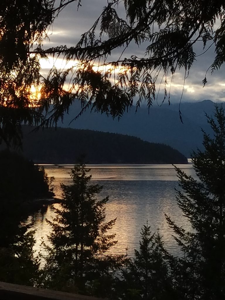
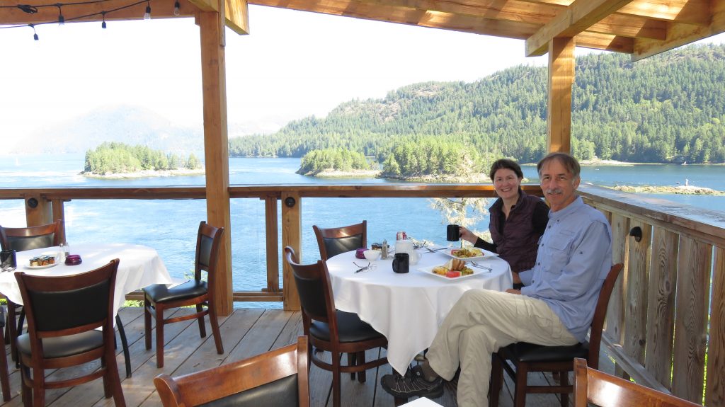
We had a wonderful breakfast at the lodge and headed out to go up the Jarvis Inlet to Chatterbox Falls. It was an extremely long Inlet and it was a gorgeous sightseeing flight even along the inlet there were many waterfalls coming down the granite cliffs from the snow above.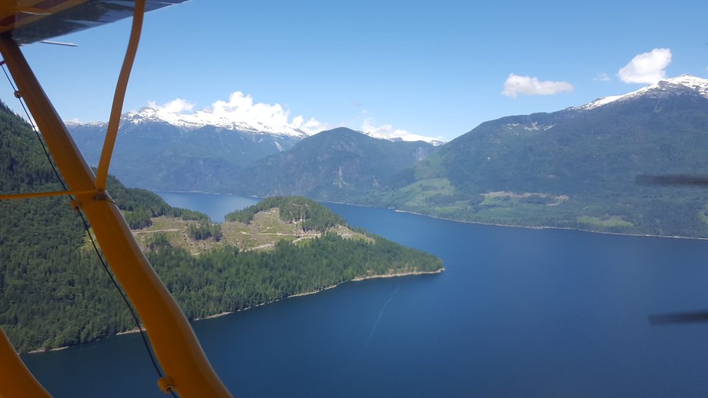


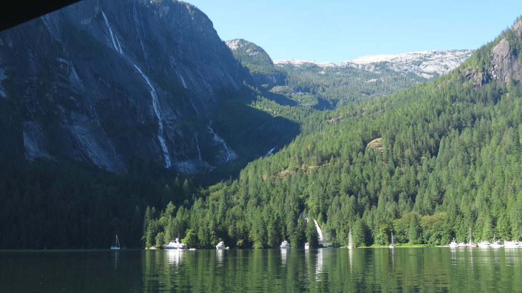
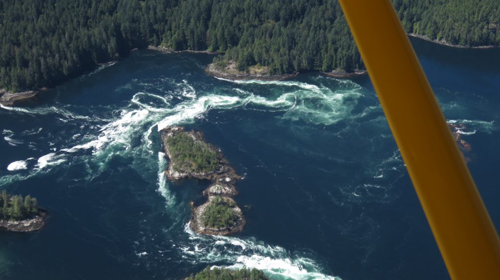
 It was hard to believe that those snow capped mountains went straight up from sea level like that! Chatterbox Falls is in a very steep narrow fjord off of the main fjord. It has a narrow opening and then a wider pocket with an island, and then another narrow spot before a slightly wider spot where the Falls are.
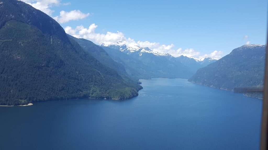
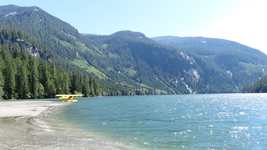
  With extremely tall mountains and such a narrow canyon, I did not want to take any chance on coming upon a extreme downdraft or updraft. I flew close to the mouth trying to feel for strong turbulence and then we went into the first part and made a circle where we could look carefully at where we would land in the inner part by the falls. It all felt good and it was spectacular to land in the bottom of that gorge, absolutely breathtaking!
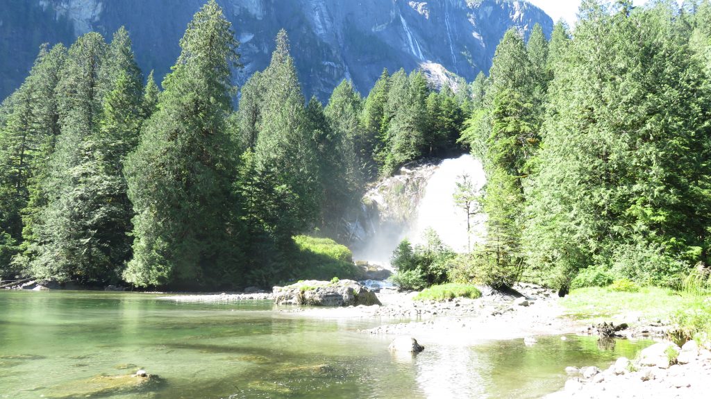
 Here is a YouTube of it. https://youtu.be/FVJz4a1e-Do
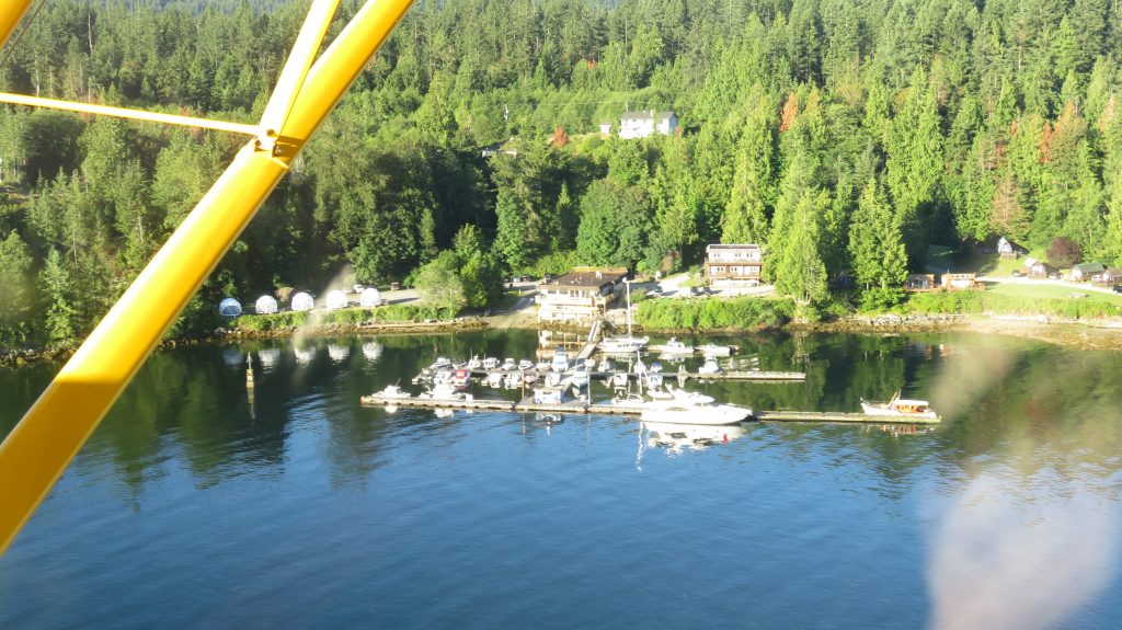
We then went the rest of the way up the inlet sightseeing more waterfalls and even some small glaciers and then headed back past the marina because it was not time yet for the current to subside and give us our opportunity to try and dock.
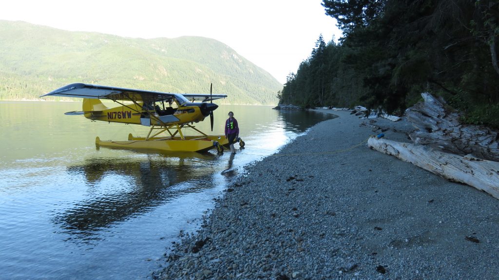
We decided to go South to Sechelt where they had an airstrip that sells fuel. When I put the landing gear selector down, three of the wheels came down for landing but one did not move. The pump was still running and trying to put it down but that wheel was still up in the float. I tried once more to move the switch up and back down but that wheel still would not extend. I could have tried hand pumping it down but it seemed like I probably had an oil leak and I chose to leave the gear up and land in the water by town where I had seen some other float planes docked. First just in open water I looked for leaks and tried it again but it did not work so we taxied over and docked by the other float planes. The dock attendant was very helpful but he was about to leave for the day and we would be stuck there because I did not feel comfortable with our fuel quantity for flying back to the resort and then somewhere else to get fuel. We decided not to troubleshoot anymore and his boss said he had to get cash from us for any fuel because they are not set up to sell fuel. He drove me to the ATM and then we put about an hour’s worth of fuel in.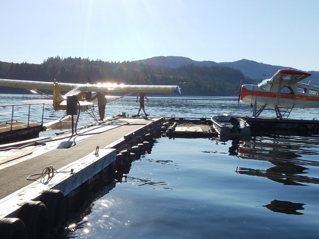 I was thinking it must be the piston seal leaking in the cylinder that extends that wheel and that I would be leaving the wheels up only landing on water all the way back to Sonoma County! I decided to try and pumping the gear just in case that gave me some new information and sure enough it did. I found that the emergency hand pump selector lever (on the floor by my right heel) was in the up position and not in the neutral position where it needs to be for the electric pump to work right. I was sure I must have moved it with my foot by accident but when I pointed it out to Julie she said that when I told her to put the water rudders up with the black handle she saw that and moved it to the up position. She felt terrible, but I could totally see how she thought that’s what I was telling her to put in the up position, (two days before). We still had some time to kill before the current was supposed to reach its lowest point so we dropped into a beach along the way just for fun.
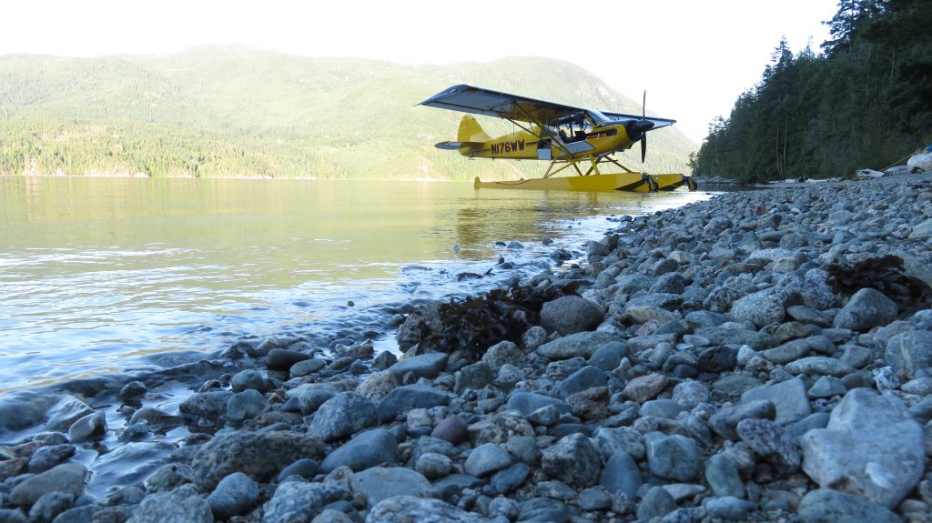
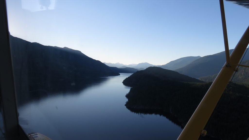 It was a beautiful spot and we waited around the shallow water picking up souvenir rocks and looking at the little baby crabs.
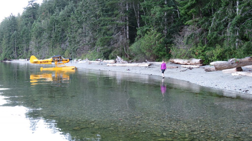
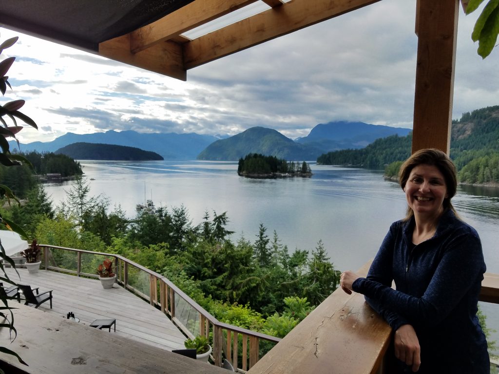
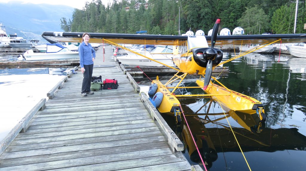
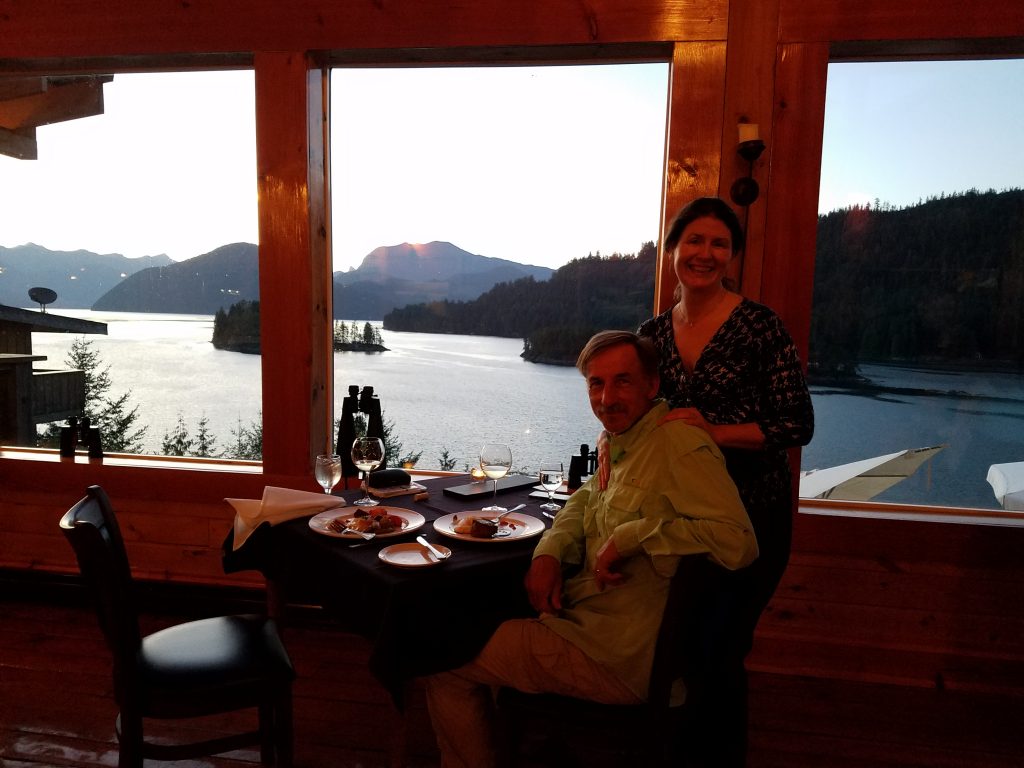
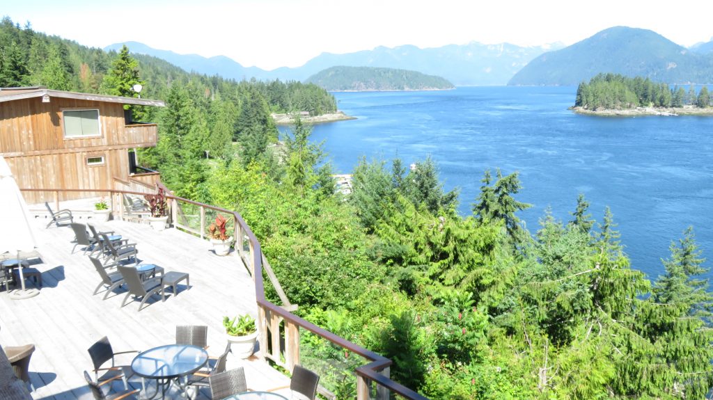
 We got back to the marina and tied up for the night and had another wonderful meal with incredible views at the lodge.
 We headed down to Sechelt to get some gas. I noticed on departure that even though the runway to the West is desirable because it is down sloping, off the end of it there is a large canyon and then a tree covered ridge that is above the departure end of the runway and it has a large set of power lines on the right that would prevent you from turning and following the Canyon to the right. The Husky did not have a problem climbing over the ridge, but I could feel the downdraft as we went over the canyon and I certainly did not like the departure situation.
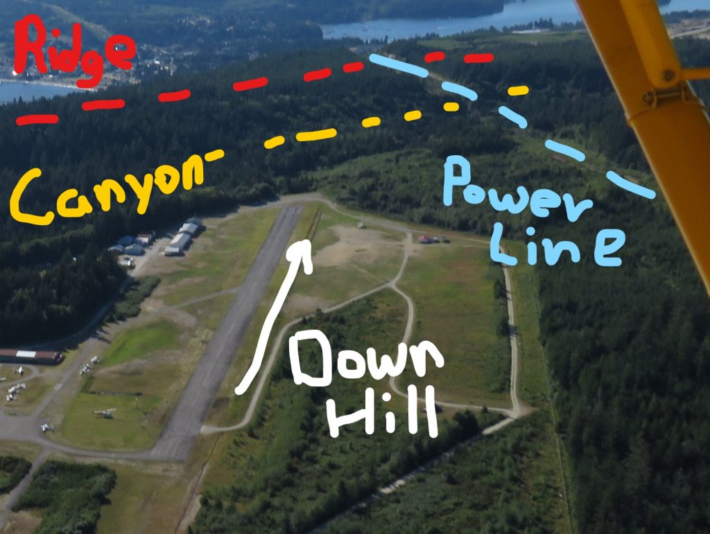 We then headed up Salmon Inlet to look at possibly landing on an alpine lake called Phantom Lake which is at about 4000 feet elevation in the mountains. The flight there was gorgeous! We climbed up to 6500 feet and it gave us a new perspective of the enormous mountain range all along that part of British Columbia.
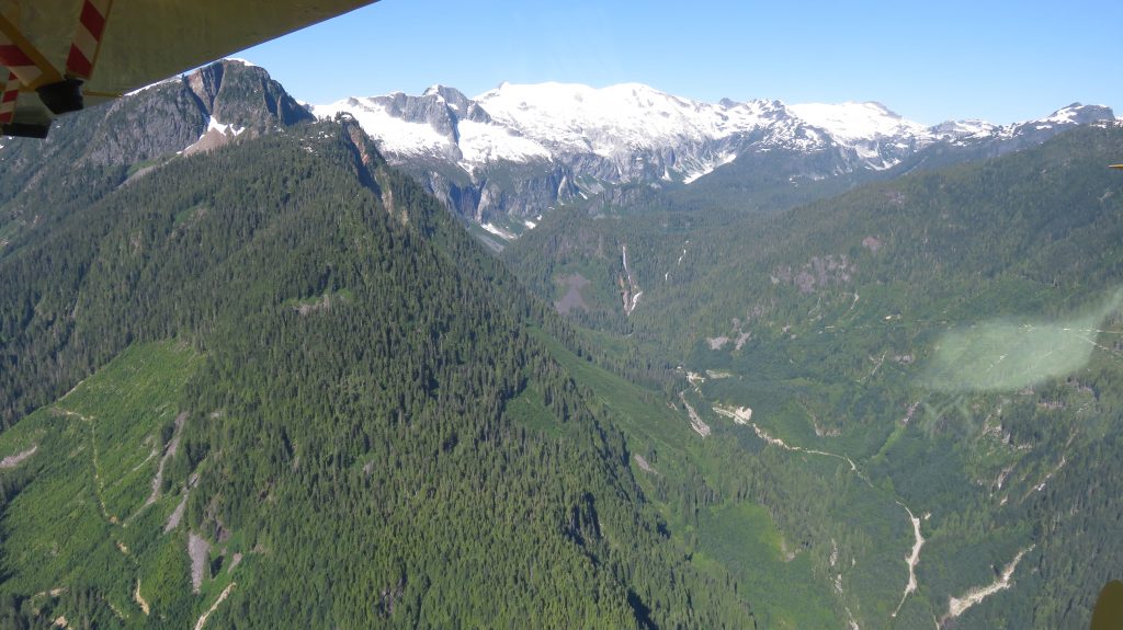
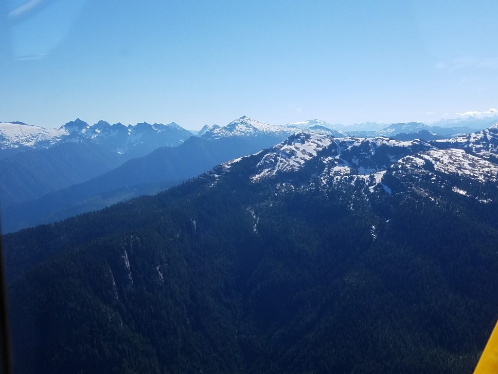 Whistler was just two canyons to our right, and we certainly could have flown over there in about 20 minutes if we wanted to, but we were enjoying the calm morning air and I would not want to be around those mountains as things warmed up and turbulence started coming off of everything. We flew over Phantom Lake and we certainly could have landed there. I expect we would have had an easy departure but I had not had the chance to talk to local pilots about how the mountain winds behave as things warm up and my instruments were already showing that because of above average temperatures the density altitude (that represents how thin the air is) was almost 2,000 ft above actual attitude and that would mean to the plane it would feel like it was taking off at 6000 feet. That definitely would give us poor takeoff performance. We headed back down valley enjoying the sightseeing and looked over Clowhom Lake.
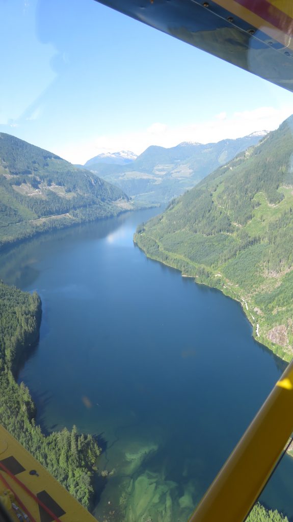 It was a nice lake but it definitely had some deadhead logs floating around and the inlet rivers looked a little difficult with shallows and stumps and rocks. We also took a very careful look at the outlet end where we would be climbing out on take-off because I knew the winds would be picking up soon and there were some very big power lines strung across the canyon down there. It looked like we had plenty of room but we needed us to memorize where everything was before we made our take off later. We decided to land and check out one of the waterfalls that was coming into the side of the lake. It did not look like I had a chance of getting up to the shore with all the rocks but it looked like it would be beautiful to taxi close to.
 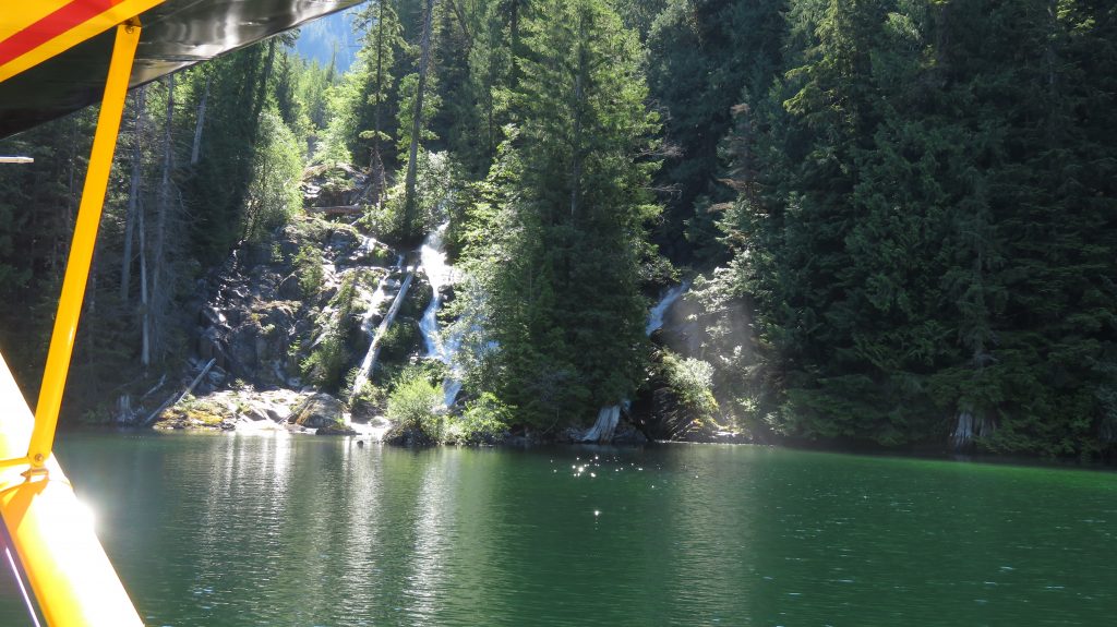 When we got close it was a gorgeous waterfall and the way the sandbar was and because the wind was still calm in that part of the lake, I dropped an anchor offshore and kept adding rope as I paddled backwards to the rocks. It worked out okay and I was able to get the plane positioned in a safe place as long as there was no wind.
 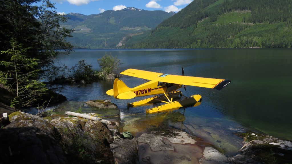 Here is a short YouTube
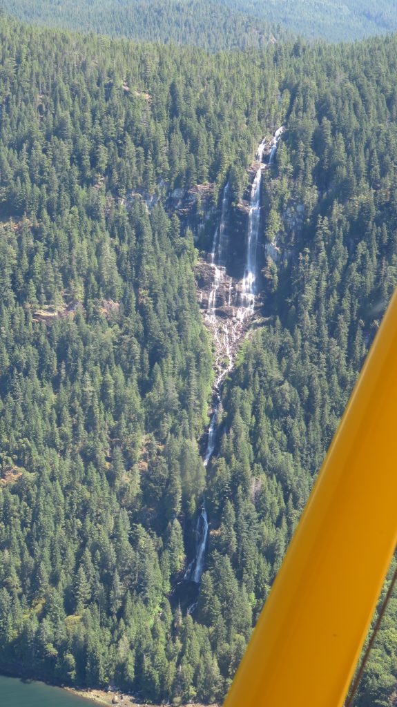
 We packed up and gave a good deal of thought to our options for a fuel stop. We could have gone back Northwest to Courtenay for fuel but even though I was positive I had plenty to make that it was certainly closer to go back to Sechelt (and I always get nervous when the fuel level gets down around 30 minutes remaining ( < 5 gallons) and that’s how we would have been landing if we went to Courtenay). I had awakened thinking about how I did not like the previous departure at Sechelt and on the flight down there. It continued to haunt me. When I called the airport common traffic frequency as I was approaching, I asked if anyone was familiar with the downdraft off the end of the runway because it sounded like they were using the same runway. The plane that was getting ready to depart said he did not think there would be any problem and I asked him more about the winds and he said that he would give me a report after he climbed out. I continued in and he did not get back to me and I went ahead and landed. As we were rolling out on the runway he told me over the radio that he had experienced a bad downdraft and almost didn’t make it over the ridge! We then noticed another plane take off in the other direction uphill with a slight tailwind and he did ok even though he was taking off up-hill but he did not have a direct tail wind, at that time it was more of a quartering tail wind. I talked with one of the local pilots about my concern and he told me that there had been a fatal accident with someone not making it over that ridge just last week! (I googled it and a Cherokee 140 with 4 on board did crash 7/5 with one fatality) I watched the winds for a while and really did not like the way they were switching up so much, even though taking off up hill would be with a quartering tailwind at least I had a good departure route where I could turn towards lower terrain right after the end of the runway.
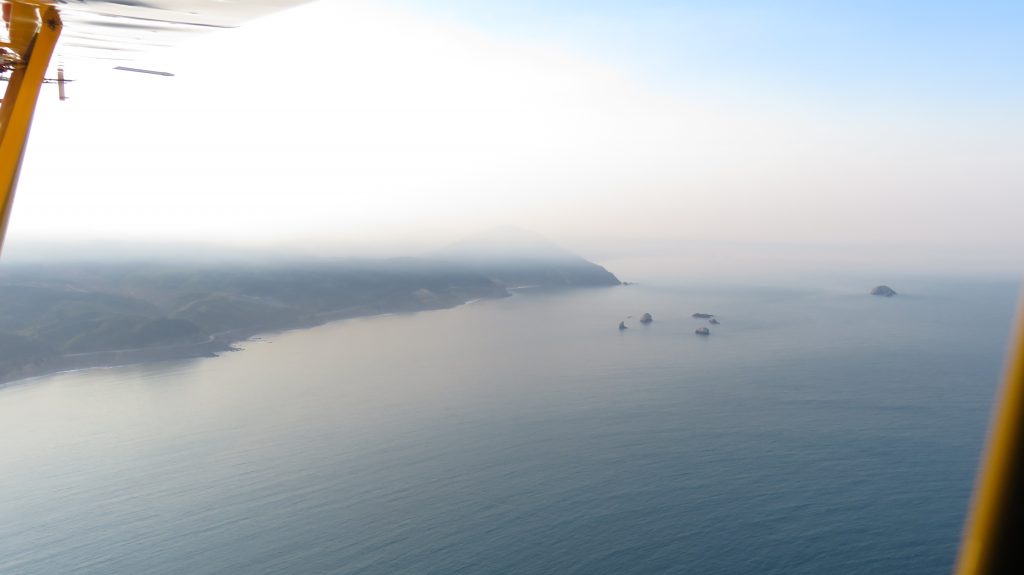
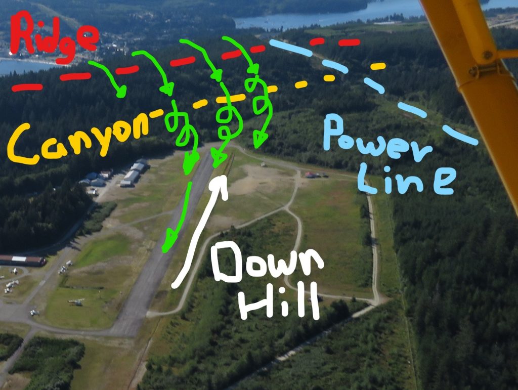 I discussed all the options with Julie including the possibility of waiting until closer to sunset when the winds would be calm and we decided to go ahead and take off in the up-hill direction. It turned out to be fine, I did make a 45 degree turn to lower ground as we went over the end of the runway rather than continuing straight over higher ground and it definitely had me on my toes and nervous taking off in those conditions. We headed out across the strait toward Nanaimo. It was fun to have one beaver flying just slightly ahead of us and two other beavers just behind and below us on the crossing. We then went down to Victoria and it was a beautiful sight seeing flight.
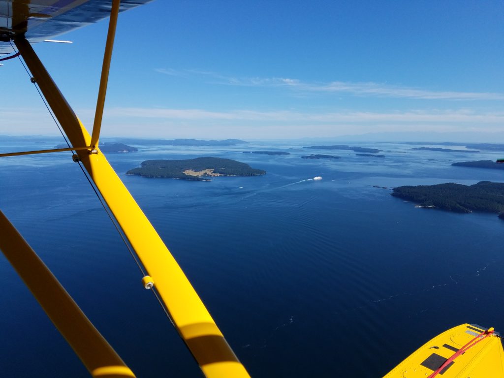 We had made arrangements for the rental car to be left at Victoria Flying Club where we were tying up for the night and then we checked into the same bed and breakfast we had been at before and picked up the gear we had left. Then it was off to a fun dinner at a very authentic Swiss Restaurant. Their menus had big cow bells on them and you could hear when anyone was looking at the menu.
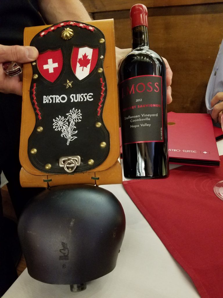 The bed and breakfast has a Rolls-Royce and the owner gave Julie a 3 a.m. ride over to the airport to catch her flight home while I got some more sleep. I had a leisurely morning at the bed and breakfast visiting with the hosts as they made breakfast.
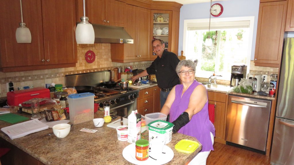 Then I spent some time with the owner and his Rolls-Royce. We raised the bonnet on the car and chatted for awhile about cars and I learned a lot about a Rolls-Royce.
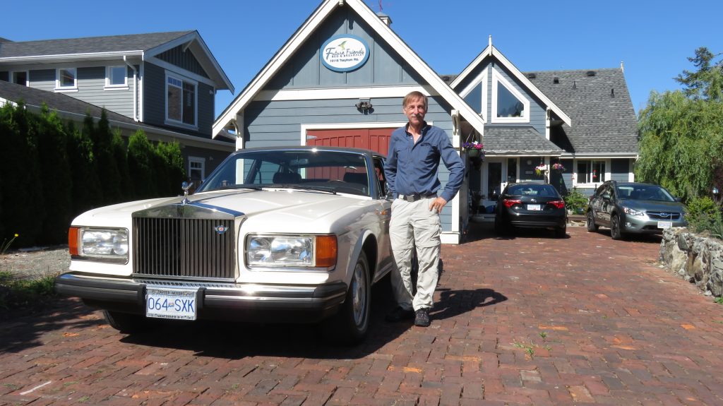 I then went out and spent almost 7 hours thoroughly washing every part of Double Shot that might have gotten salt water on it, it felt good to get it all cleaned up.
 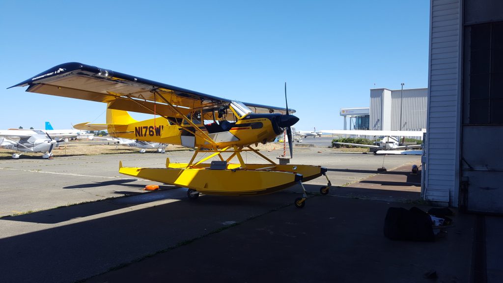 I then had a nice lunch and a leisurely flight back up to Courtenay.
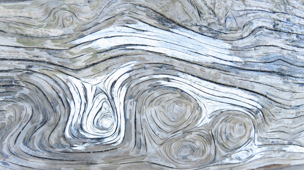
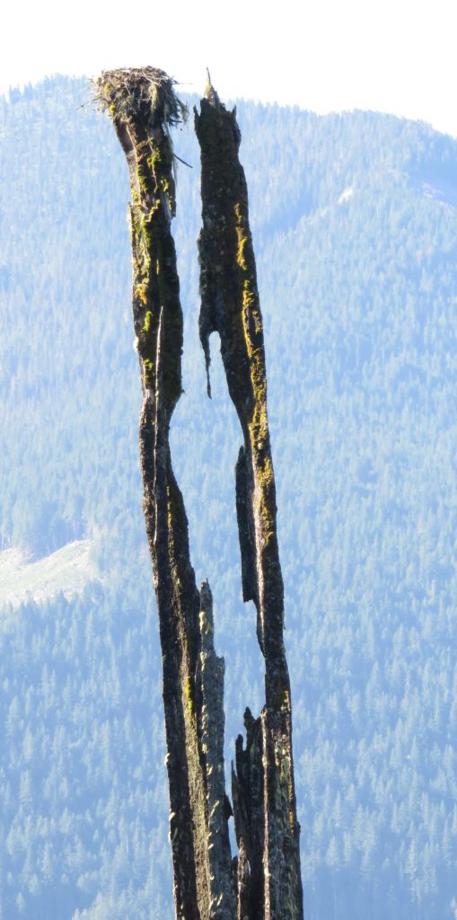
 I looked around in the sand and sure enough, found some Grizzly tracks. There were also wolf tracks but they were difficult to get a good picture of.
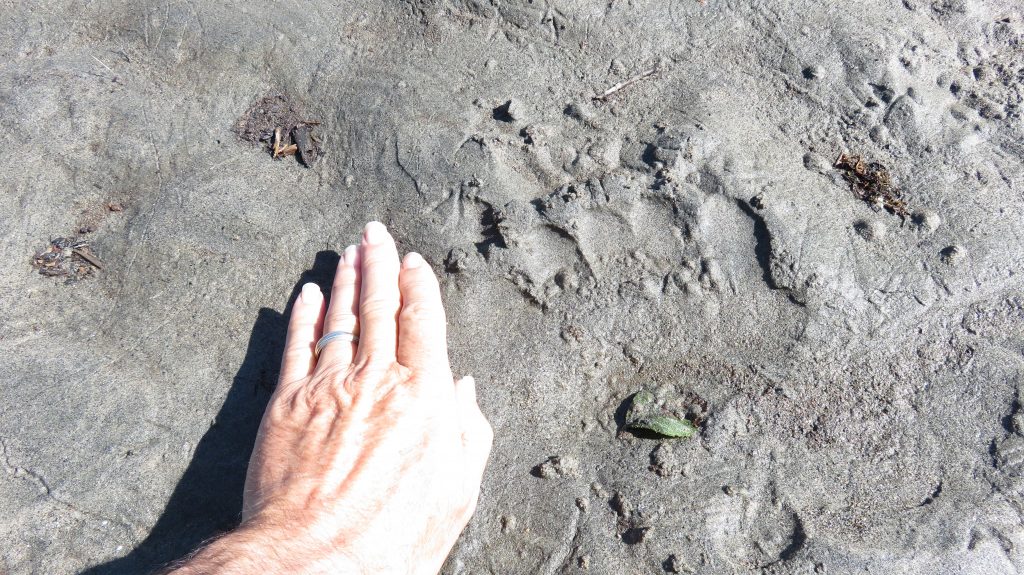 You can tell it is not a black bear because the toes are almost in a straight line. I went down and tried another inlet for a while, but it also did not have conditions that were really good for anchoring and fishing from the plane or fishing from shore.
 I went back and tried anchoring off the main Inlet but it was a sandy bottom with nothing to catch the anchor on and the winds were picking up. I headed back to Cortenay rather disappointed that I had not caught any really big trout or Dolly Varden on the lake that day. I was feeling rather down about it and thinking that I would try some other place but then I decided to go back the next day and give it another try.
 I took my time on the way back and explored some different lakes along the way but the afternoon winds were whipping up and I chose to just land back at Courtenay.
 Powell Lake is a very large lake, it is over 30 miles long and 1100 ft deep. It also has an enormous number of floating cabins on it some of them are basically very large homes with even garages attached for their boats. When I got there the winds were already getting strong on the majority of the lake, I continued up to the far Northern tip and the strong winds had not gotten up there yet. I found a landing spot but there were quite a few logs floating around. I then taxied up to the river inlet but there was kind of a forest of dead trees.

 As I taxied though them I imagined what would happen if I lost power and the wind kicked up, they looked like they were just made to take wings off of float planes. Sure enough the strong winds soon reached the Northern end of Powell Lake where I was and I took off and headed back south. The winds were extremely strong across the lake and I was getting tossed around with quite a bit of turbulence. I had not had any breakfast yet because I expected to be landing just 25 miles away from Courtenay and having a breakfast stop on some peaceful lake, instead, I had been chased around by the wind for over two hours and really wanted a break.
 Also when I arrived at the Orcas camping area I was surprised to find out that there is a Gay Pilots group “
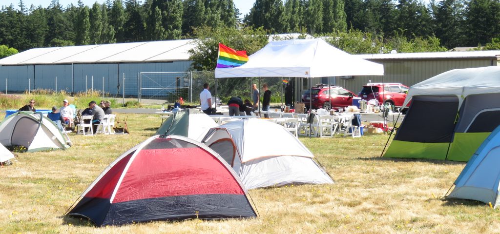 I walked into town for some dinner and a few breakfast and lunch items for the next day. I chose to park and camp in the asphalt parking area, I find that with my excellent sleeping pad I can be more comfortable on flat asphalt than trying to find a place in the grass that does not have little humps and bumps to annoy me all night.
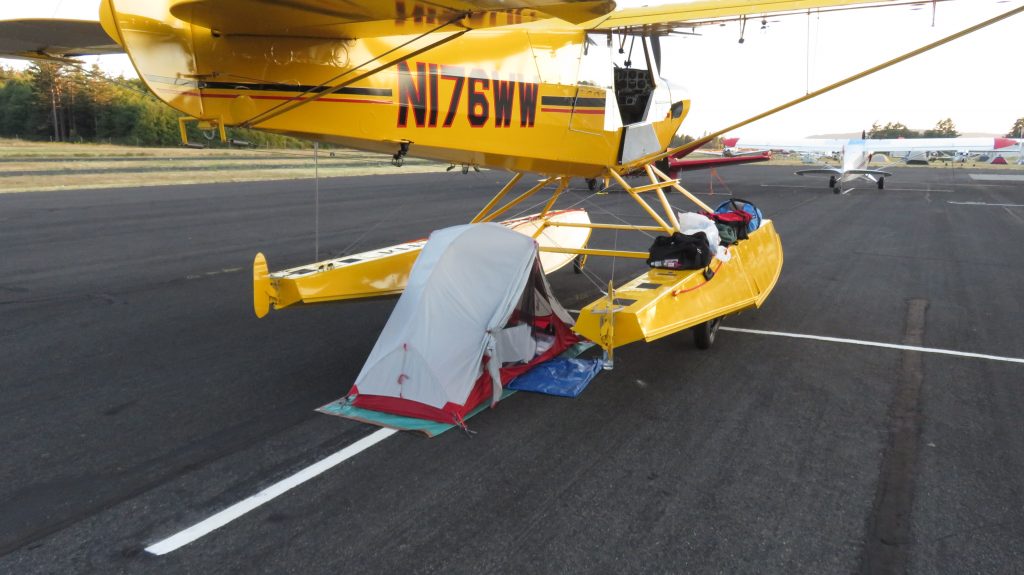 As I was packing things up, the airport attendant that goes around to all the planes and leaves a overnight fee envelope ($10) on each plane came by. As he was walking up I said “OH, I just got here”. He looked a little startled and exclaimed, “I saw you yesterday, and you have a tent”! He then saw my smile and we both got a big laugh.
 As I was having lunch, I Google Mapped around the Northern half of Oregon for a small airport to camp at that is close enough to town for me to walk to a restaurant for dinner. Sportsman seemed to meet that criteria and I called them up and confirmed just to be sure. It was a bumpy afternoon ride down there with convective turbulence and I was glad I had not chosen to spend the night farther south. The airport is a family operation and I think it is third generation running the fuel truck now.
 Kind of a strange time warp place and the Pilot’s Lounge had been a house previously and it still looked very much like someone’s living room.
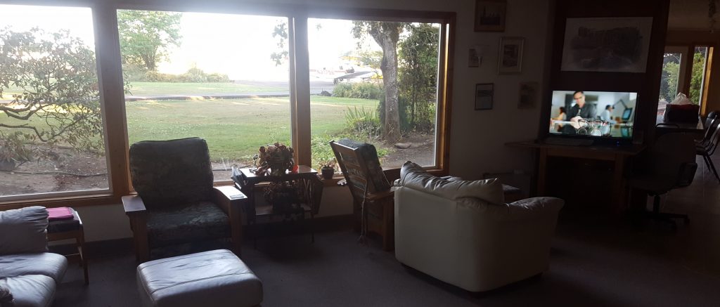
 I worked on this trip story site on the table while I listened to M*A*S*H* reruns on the TV. I walked into town and had a great Mexican food dinner. And fell asleep gazing at the stars.
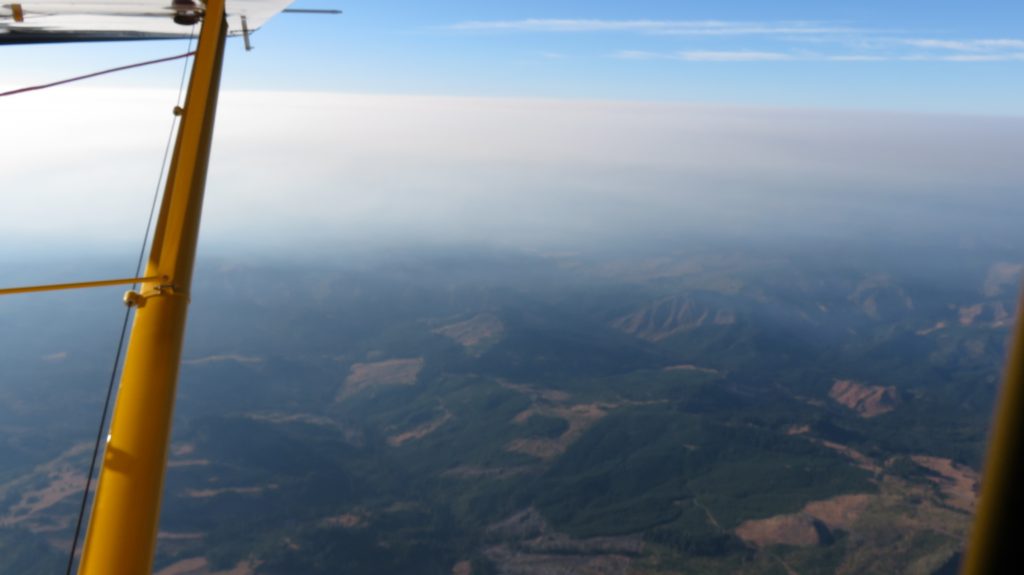
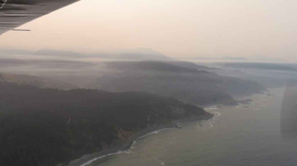 A few times there was some fog around and the smoke did get rather stratified and had some thick patches drifting in low but I kept maintaining options of airports I could go back to and land if I had to and it worked out quite well to get all the way down to Arcata.
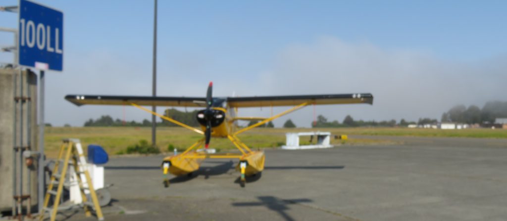 I put some fuel in and took a rest break watching the fog bank that was sitting right at the edge of the runway and then I had a smooth flight back home to Santa Rosa.